
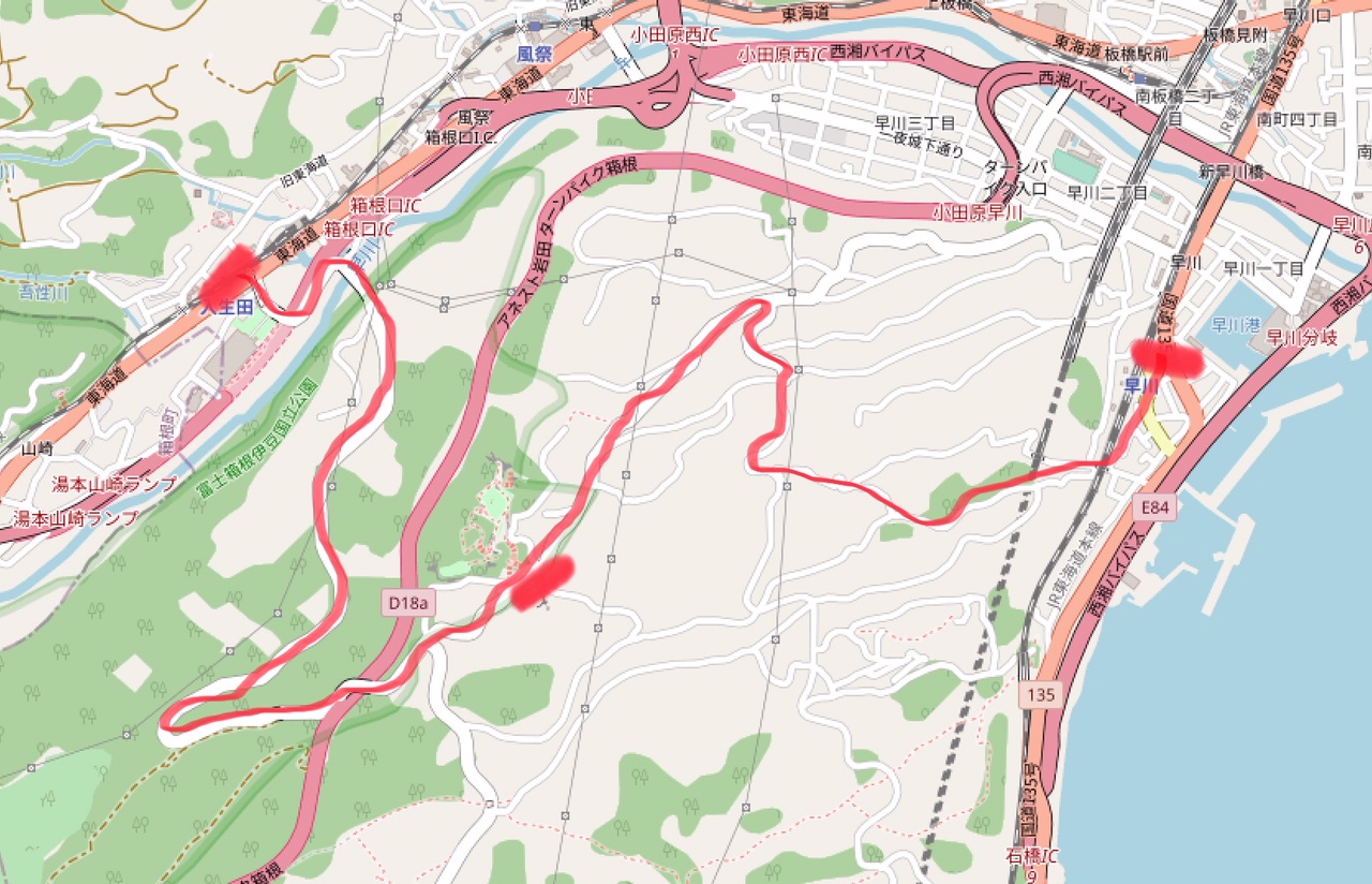
Through the southwest part of Odawara city is flowing the Hayakawa river that comes from Hakone. The district of Odawara that is west of the river is called Hayakawa (see figure below) and besides a harbor and small urban area, a large part of it are mountains with fruit farms. And exactly this mountain area is a heaven for people that like walking or easy hikes, nature and scenic views.

The location is very easy accessible by train from Tokyo as many trains from Tokyo stop at Hayakawa station. Also it is not such a long trip, maximum 1 hour and 30 minutes from Tokyo station.
Of course you can decide your own route. But since there are so many possibilities, you be wanting some advise. So on this page there will be introduced three recommended walking trails in the Hayakawa area.
Trail 1: Hayakawa short course
Both the starting and end point are at Hayakawa station for this route. The walking duration is around 2 hours. The route includes walking through fruit farms and a forest with large trees, passing a castle ruins site and spots with amazing views on the Sagami bay as well as Hakone.

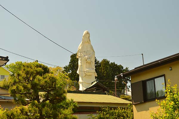
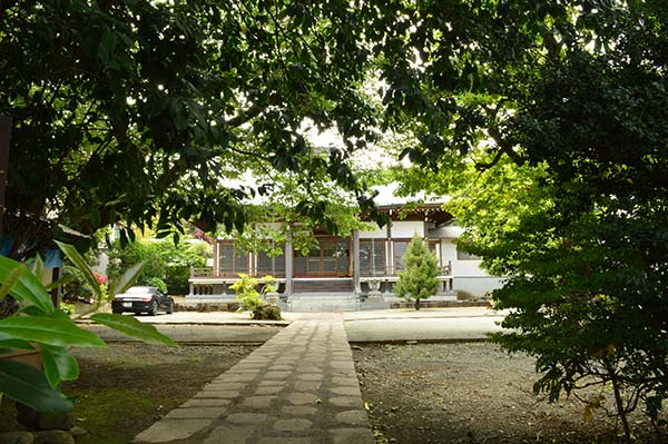
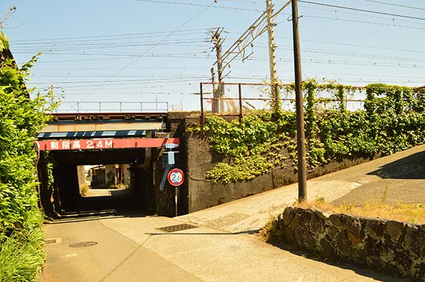
It is advised to take the clockwise route. Exiting from Hayakawa station, you can go either left or right to go towards the mountains. The left side is preferred as it is more easy and has a better atmosphere. So once you leave the station, go to the left and walk along the big route for 1 or 2 minutes until you reach a small tunnel. Pass under the train tracks and go left at the fork. The road will go up a little but and at the intersection, go to the left (or straight if you would like to visit a temple or buddha statue.
After you go to the left you will pass another temple and after that there is a T junction. Turn to the right here towards the mountains.
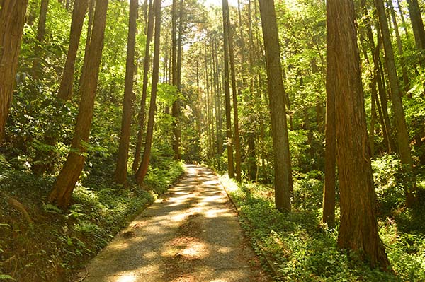
Continuing this road, you will pass through a small forest with very high trees.
A little bit after, there is a fork, take the left route here.

Now just keep going straight on the road you are on. Passing in between many fruit farms, you will reach a big round tunnel. Pass through and keep going straight.

A few minutes further up you there will be a small intersection, turn right up and then take a left at the next fork. Keep following the road until you reach a bigger road, go left here to arrive at Ichiya castle park which is great rest area.

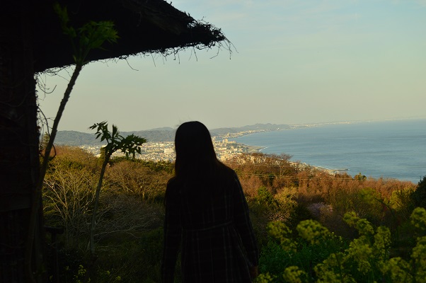
There is a cafeteria, small flower park and great view on the Sagami bay.
To continue the route, just follow the big road down the mountain. This is a mixed road for pedestrians and cars. The lower half has great views on the Hakone valley as well as Odawara city. The bottom of this road ends at the Shinkansen track. Pass under it and then go to the right. You will end at the Buddha temple statue from the beginning again.
Trail 2: Hayakawa long course
Like trail 1, this trail starts and ends at Hayakawa station. This is a longer route though, expect to walk for around 3-4 hours. The route has a similar atmosphere as trail 1 with a lot of fruit farms and great viewpoints. As you go deeper into the nature, there is a higher chance to spot wildlife.

For this route it is advised to walk it anti-clockwise. Exit the station, turn left, follow the big road for 1-2 minutes and go the left through a small tunnel under the train tracks. Then take the fork to the left and at the intersection, go to the right. At the end of this road go to the left and pass under the Shinkansen tracks.

Some stairs will lead you to a temple. From temple main grounds, you can exit to the right.
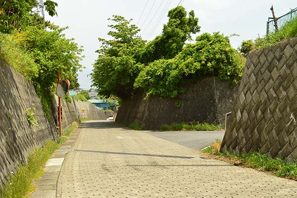
You will end up at a small mountain road. Go to the left here. Keep following this road for around 15 minutes until you reach a bigger road intersection. Go to the left here. Follow this main road until around the corner where there is an intersection again. Go right here up the small road.

Follow it for around 10 minutes until it merges into a bigger road. Go upwards the mountain and you will reach the Ichiya castle park which is a great spot for a rest. To continue the route, go further up the mountain via the path that is next to the castle ruins.

Cross the small path.

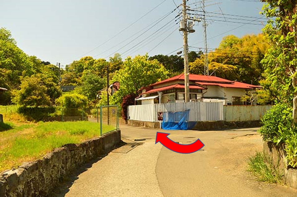
It will end up at an intersection. Go straight. (the below picture is from a different viewpoint)

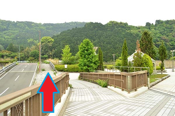
The road you now entered is also a big road but since it is still under construction (as of 2021), there is almost no traffic. Continue walking on this road for 15-20 minutes after which you pass over a bridge that crosses the Tamagawa river.

After the bridge there is an entrance to the right. Take it and after that go right downwards the mountain.

Walking along the river you will find several ruins of what used to be an blooming farm area. Keep following the river until you reach a small town. The first road to the left (bridge over the small river) will guide you up the mountain again.

Follow this road for 15 minutes to reach a bigger road again. Go to left onto this road and follow it until you reach picknick tables and a public toilet. It is a good rest spot to enjoy the view before the route will take you down again towards the station.

So take the sideroad down and after 15 minutes going down, you will reach the train tracks. Pass under it and go the left to walk towards the station. 5 minutes of walking later you should have arrived at Hayakawa station.
Trail 3: Hayakawa – Iriuda course
The third trail is between Hayakawa (JR line) and Iriuda (Odakyu line) stations. Either direction is good, but from Iriuda to Hayakawa gives you better views while going from Hayakawa to Iriuda is nice because you can enjoy the Hayakawa riverside at the end as a resting place.
The required walking time for this trail is around 2 hours. In addition to crossing the Hayakawa river, you will also cross the Hakone Turnpike which leads to Taikanzan, pass the Ichiya castle park and many fruits farms.
For this example, we take the Iriuda to Hayakawa direction. Exiting from Iriuda station, go to the right and walk a bit on the road along the train tracks until you reach the tunnel. Go through the tunnel under the train tracks and cross the road (there is a pedestrian bridge). It will lead you to the Kanagawa prefectural museum. It is also worth a visit but if you would like to walk the route, just keep following the pedestrian path.
You will reach the Hayakwa river. Cross the bridge and keep continuing on this road.

After around 1 hour of climbing you will arrive at the Ichiya castle park. A good timing for a rest. Afterwards you can continue following the road that goes down the mountain again. Approximately 15 minutes later there will be an intersection, go to the right here and walk along this normal road which does not have a dedicated pedestrian area.
This road is not so crowded but occasionally a car can pass. Walk for 15 to 20 minutes until you reach a small water fountain on the right side of the road. After this there is an entrance to the right.

Go immediately left after and go through the tunnel under the road. This road can be followed all the way down the mountain until you reach the train tracks.
Pass under it and go to the left to go to Hayakawa station.
For more walking routes in the Odawara area see the website of Odawara city:
http://www.city.odawara.kanagawa.jp.e.aez.hp.transer.com/kanko/walking/